
Owase, Mie / 馬越峠(熊野古道伊勢路)
Magose Pass (Kumano Kodo Iseji)
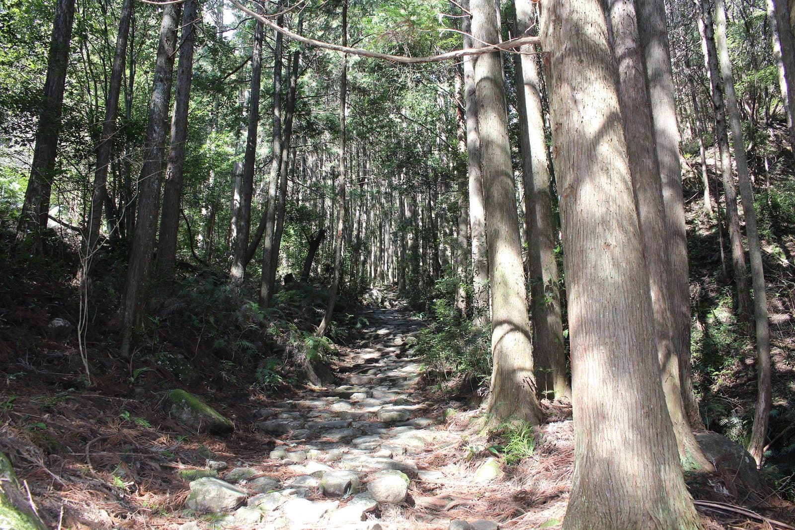
A popular pass on the border of Kihoku and Owase, where the finest stone paving on the Kumano Kodo Iseji runs through beautiful Owase cypress forest, with historic sites such as the "Yonaki Jizo". Trails from the pass lead up Mt. Tengukura and Mt. Binshi, and Magose Park below is a cherry-blossom spot. The course (Michi-no-Eki Miyama to JR Owase Station) is about 5 km and takes about 2.5 hours.
Last official check
26 Sept 2026
Traveler reports
0
Reports open in Phase 2
Next scheduled check
25 Dec 2026
Decide before you go
A short summary made from the official facts below. Check the rows for details.
- Getting there
- Train
Before you go
Only facts we confirmed on official sources are shown. Anything else is marked “Not checked yet”.
- Opening hours
Not checked yet — we have not confirmed this on an official source yet. Check with the spot before you go.
- Closed
Not checked yet — we have not confirmed this on an official source yet. Check with the spot before you go.
- Admission
Not checked yet — we have not confirmed this on an official source yet. Check with the spot before you go.
- Getting there
About 30 minutes on foot from Aika Station (JR Kisei Line).
Checked 26 Sept 2026 on the official site- Parking
Use the Michi-no-Eki Miyama car park or others.
Checked 26 Sept 2026 on the official site- Payment
Not checked yet — we have not confirmed this on an official source yet. Check with the spot before you go.
- Accessibility
Not checked yet — we have not confirmed this on an official source yet. Check with the spot before you go.
Found wrong or outdated information? Let us know
Official site: https://www.kankomie.or.jp/spot/21629
Location
Smaller pins are other spots nearby.
Nearby spots
- No photo yetMie Prefectural Kumano Kodo CenterMie5 km away (straight line)
- No photo yetMatsumoto Pass (Kumano Kodo Iseji)Mie24 km away (straight line)
Distances are straight-line distances, not travel distances.
Crowds
- Crowd level
Not checked yet — no official source yet, and not enough traveler reports.
- Best time to visit
Not checked yet — no official source yet, and not enough traveler reports.
- Peak time
Not checked yet — no official source yet, and not enough traveler reports.
- Busiest days
Not checked yet — no official source yet, and not enough traveler reports.
- Busiest season
Not checked yet — no official source yet, and not enough traveler reports.
- Latest traveler report
- None yet
Traveler crowd data by time of day appears after 5 traveler reports (0 so far).
You can check typical busy hours in Google Maps ("Popular times" on the place's page). Open this spot in Google Maps
Verification log
- 26 Sept 2026First check · Tourism board · https://www.kankomie.or.jp/spot/21629Access, parking, description and coordinates read from a tourism organization's site.