
Nagaizumi, Shizuoka / 鮎壺の滝
Ayutsubo Falls
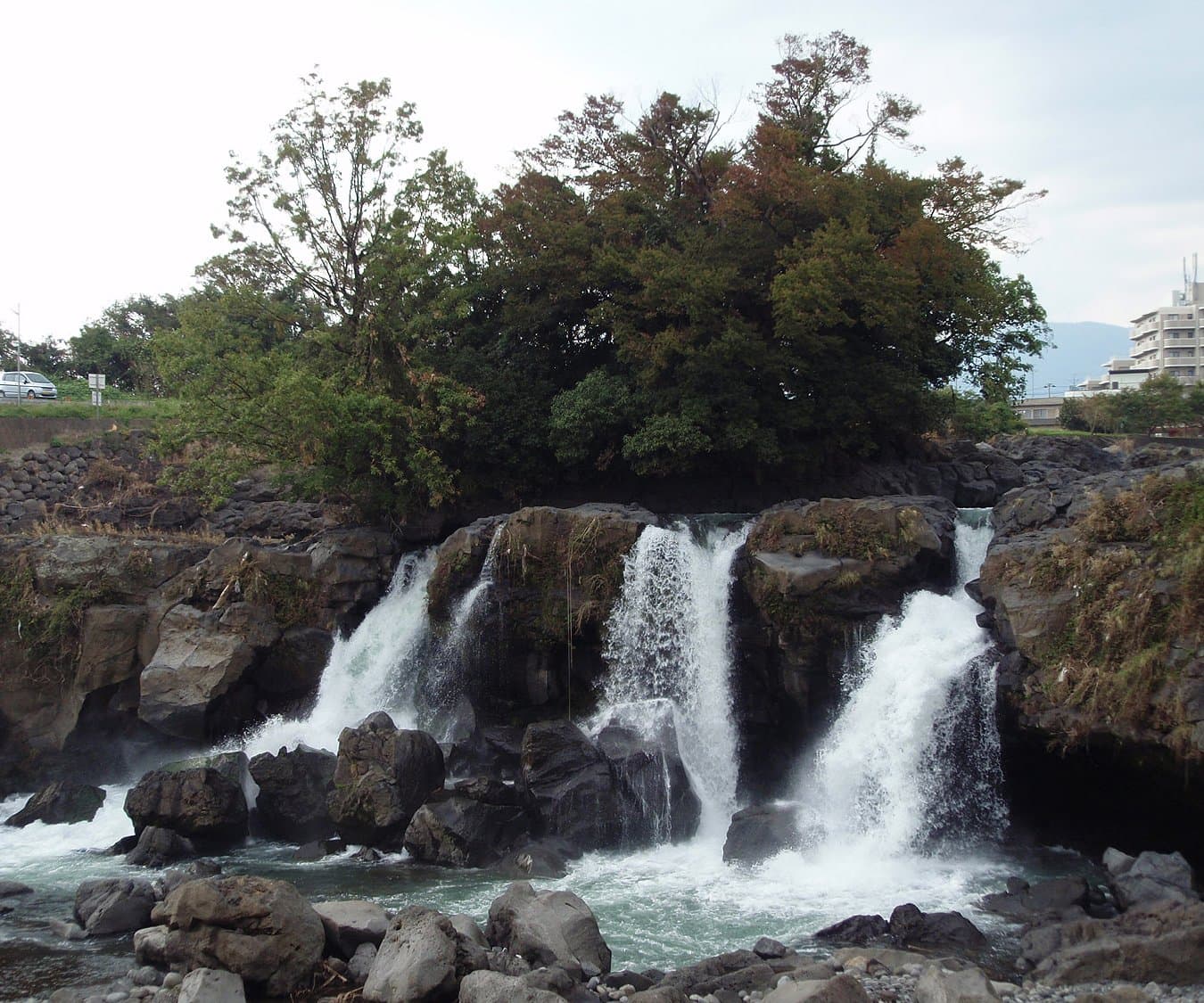
On the Kise River at the border of Nagaizumi and Numazu, at the south-western end of the Mishima lava that flowed from Mt. Fuji about 10,000 years ago. The river wore away the soft loam under the lava, leaving hard lava as a cliff about 9 m high and 65 m wide, with many streams falling between the rocks. It is a Shizuoka Prefecture natural monument and a geosite of the Izu Peninsula Geopark. The name comes from sweetfish (ayu) that gathered in the plunge pool, unable to climb the falls; it is also called "Aitsubo" for its indigo-blue pool and "Fujimi" for its view of Mt. Fuji. Lava layers and lava tree moulds can be seen.
Last official check
27 Sept 2026
Traveler reports
0
Reports open in Phase 2
Next scheduled check
26 Dec 2026
Decide before you go
A short summary made from the official facts below. Check the rows for details.
- Getting there
- Train / Car
Before you go
Only facts we confirmed on official sources are shown. Anything else is marked “Not checked yet”.
- Opening hours
Not checked yet — we have not confirmed this on an official source yet. Check with the spot before you go.
- Closed
Not checked yet — we have not confirmed this on an official source yet. Check with the spot before you go.
- Admission
Not checked yet — we have not confirmed this on an official source yet. Check with the spot before you go.
- Getting there
About 5 minutes on foot from JR Shimotogari Station; about 30 minutes from Numazu IC (Tomei); about 10 minutes from Nagaizumi-Numazu IC (Shin-Tomei).
Checked 27 Sept 2026 on the official site- Parking
Use the adjacent Ayutsubo Park car park (free), open 9:00-18:00 (no entry or exit outside these hours); coach parking available.
Checked 27 Sept 2026 on the official site- Payment
Not checked yet — we have not confirmed this on an official source yet. Check with the spot before you go.
- Accessibility
Not checked yet — we have not confirmed this on an official source yet. Check with the spot before you go.
Found wrong or outdated information? Let us know
Address: Nagaizumi, Shizuoka (Japanese address: 静岡県長泉町下土狩)
Official site: https://hellonavi.jp/spot/1076
Location
Smaller pins are other spots nearby.
Nearby spots
- No photo yetMishima Taisha ShrineShizuoka3 km away (straight line)
 Photo: Qurren / Wikimedia Commons, CC BY-SA 3.0 (resized)Kakitagawa ParkShizuoka3 km away (straight line)
- No photo yetNumazu Deep Sea Aquarium (Coelacanth Museum)Shizuoka6 km away (straight line)
- No photo yetNumazu Port Observation Floodgate "View-o"Shizuoka7 km away (straight line)
- No photo yetMishima SkywalkShizuoka8 km away (straight line)
Distances are straight-line distances, not travel distances.
Crowds
- Crowd level
Not checked yet — no official source yet, and not enough traveler reports.
- Best time to visit
Not checked yet — no official source yet, and not enough traveler reports.
- Peak time
Not checked yet — no official source yet, and not enough traveler reports.
- Busiest days
Not checked yet — no official source yet, and not enough traveler reports.
- Busiest season
Not checked yet — no official source yet, and not enough traveler reports.
- Latest traveler report
- None yet
Traveler crowd data by time of day appears after 5 traveler reports (0 so far).
You can check typical busy hours in Google Maps ("Popular times" on the place's page). Open this spot in Google Maps
Visiting respectfully
- RulesNo pets.Checked 27 Sept 2026 on the official site
Verification log
- 27 Sept 2026First check · Tourism board · https://hellonavi.jp/spot/1076Access, parking, cautions and rules, description, address and coordinates read from a tourism organization's site.