
Niihama, Ehime / 別子ライン
Besshi Line
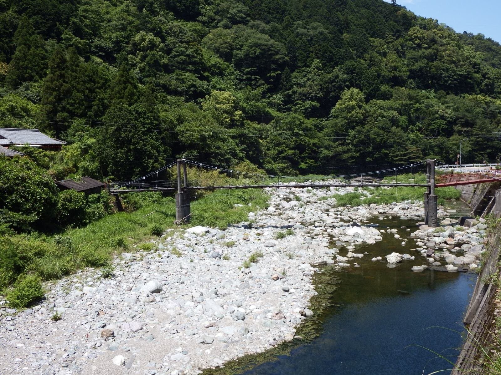
A scenic gorge of about 10 km on the upper Kokuryo River, which flows through the centre of Niihama, named for its likeness to the gorges of the Rhine in Germany. It has cherry blossoms in spring, fresh greenery in summer and autumn leaves, and has been chosen for the New 100 Views of Japan, the 20 Views of Shikoku and Shikoku's 100 natural sites. Near the bright vermilion Namago Bridge the autumn leaves are especially beautiful, and Prefectural Road 47 along the gorge makes it a scenic drive.
Last official check
28 Sept 2026
Traveler reports
0
Reports open in Phase 2
Next scheduled check
27 Dec 2026
Decide before you go
A short summary made from the official facts below. Check the rows for details.
- Getting there
- Train / Car
Before you go
Only facts we confirmed on official sources are shown. Anything else is marked “Not checked yet”.
- Opening hours
Not checked yet — we have not confirmed this on an official source yet. Check with the spot before you go.
- Closed
Not checked yet — we have not confirmed this on an official source yet. Check with the spot before you go.
- Admission
Not checked yet — we have not confirmed this on an official source yet. Check with the spot before you go.
- Getting there
About 10 minutes by car from JR Niihama Station or from Niihama IC.
Checked 28 Sept 2026 on the official site- Parking
None.
Checked 28 Sept 2026 on the official site- Payment
Not checked yet — we have not confirmed this on an official source yet. Check with the spot before you go.
- Accessibility
Not checked yet — we have not confirmed this on an official source yet. Check with the spot before you go.
Found wrong or outdated information? Let us know
Address: Niihama, Ehime (Japanese address: 愛媛県新居浜市立川地区)
Official site: https://www.iyokannet.jp/spot/90
Location
Smaller pins are other spots nearby.
Nearby spots
- No photo yetMichi-no-Eki Minetopia BesshiEhimeLess than 1 km away (straight line)
- No photo yetTonaru (Besshi Copper Mine Ruins)Ehime3 km away (straight line)
- No photo yetEhime Prefectural Science MuseumEhime6 km away (straight line)
 Photo: muneaki / Wikimedia Commons, CC BY-SA 3.0UFO LineKochi15 km away (straight line)
- No photo yetmont-bell Outdoor Oasis IshizuchiEhime19 km away (straight line)
Distances are straight-line distances, not travel distances.
Crowds
- Crowd level
Not checked yet — no official source yet, and not enough traveler reports.
- Best time to visit
Not checked yet — no official source yet, and not enough traveler reports.
- Peak time
Not checked yet — no official source yet, and not enough traveler reports.
- Busiest days
Not checked yet — no official source yet, and not enough traveler reports.
- Busiest season
Autumn leaves near the Namago Bridge are beautiful and draw many visitors every year.
Checked 28 Sept 2026 on the official site- Latest traveler report
- None yet
Traveler crowd data by time of day appears after 5 traveler reports (0 so far).
You can check typical busy hours in Google Maps ("Popular times" on the place's page). Open this spot in Google Maps
Verification log
- 28 Sept 2026First check · Local government · https://www.iyokannet.jp/spot/90Access, parking, description, address and coordinates read from the local government's site.