
Nirasaki, Yamanashi / 甘利山
Mt. Amari
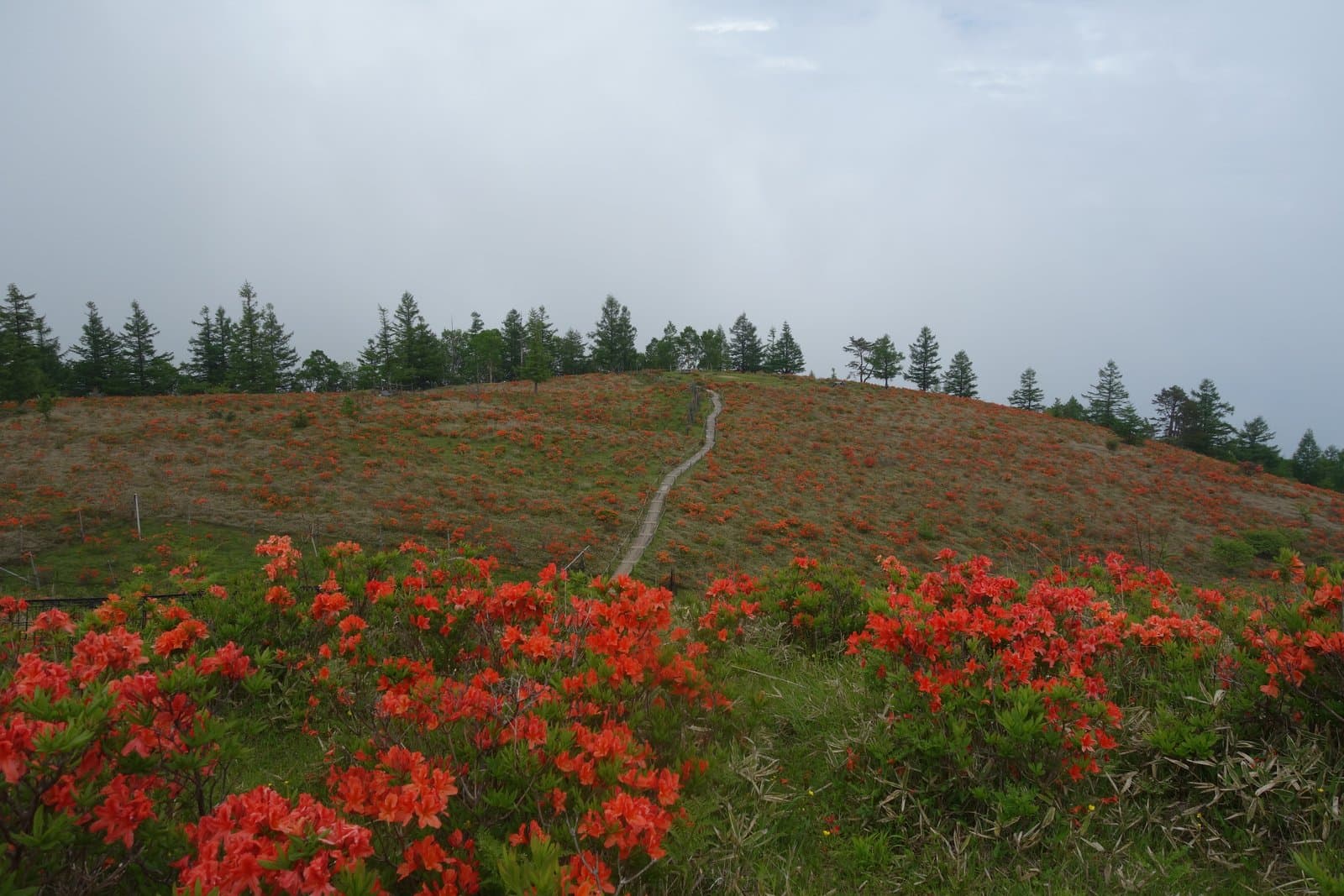
One of the "100 mountains of Yamanashi", a foothill of the Southern Alps' Hoo Sanzan in western Nirasaki. The summit is about 30 minutes from the Amariyama Hirogawara car park at the trailhead, and the arbour about 5 minutes from the trailhead is a Mt. Fuji viewpoint. From early to mid June a sea of Japanese azaleas (renge-tsutsuji) is in full bloom.
Last official check
26 Sept 2026
Traveler reports
0
Reports open in Phase 2
Next scheduled check
25 Dec 2026
Before you go
Only facts we confirmed on official sources are shown. Anything else is marked “Not checked yet”.
- Opening hours
Not checked yet — we have not confirmed this on an official source yet. Check with the spot before you go.
- Closed
Not checked yet — we have not confirmed this on an official source yet. Check with the spot before you go.
- Admission
Not checked yet — we have not confirmed this on an official source yet. Check with the spot before you go.
- Getting there
About 30 minutes to the summit from the Amariyama Hirogawara car park at the trailhead.
Checked 26 Sept 2026 on the official site- Parking
Amariyama Hirogawara car park (trailhead).
Checked 26 Sept 2026 on the official site- Payment
Not checked yet — we have not confirmed this on an official source yet. Check with the spot before you go.
- Accessibility
Not checked yet — we have not confirmed this on an official source yet. Check with the spot before you go.
Found wrong or outdated information? Let us know
Address: Nirasaki, Yamanashi (Japanese address: 山梨県韮崎市西部)
Official site: https://www.yamanashi-kankou.jp/special/21meizan/amariyama.html
Location
Approximate location: this pin comes from Wikidata (a public database), not from an official page. We checked that it is close to the official address. This point is the summit, not a trailhead or ropeway station.
Smaller pins are other spots nearby.
Nearby spots
- No photo yetRyuo Radon Onsen Yu-topiaYamanashi13 km away (straight line)
- No photo yetRoadside Station Nishijima Washi-no-Sato Kamisuki ParkYamanashi23 km away (straight line)
Distances are straight-line distances, not travel distances. Some locations are approximate, so treat these distances as a rough guide.
Crowds
- Crowd level
Not checked yet — no official source yet, and not enough traveler reports.
- Best time to visit
Not checked yet — no official source yet, and not enough traveler reports.
- Peak time
Not checked yet — no official source yet, and not enough traveler reports.
- Busiest days
Not checked yet — no official source yet, and not enough traveler reports.
- Busiest season
Early to mid June is peak season for the azaleas, and it gets busy with climbers and visitors.
Checked 26 Sept 2026 on the official site- Latest traveler report
- None yet
Traveler crowd data by time of day appears after 5 traveler reports (0 so far).
You can check typical busy hours in Google Maps ("Popular times" on the place's page). Open this spot in Google Maps
Visiting respectfully
- NatureIf you enter the mountain forest, you are asked to watch out for bears.Checked 26 Sept 2026 on the official site
Verification log
- 26 Sept 2026First check · Tourism board · https://www.yamanashi-kankou.jp/special/21meizan/amariyama.htmlHours and description read from a tourism organization's site.